Bill Rankin, 2005
download:
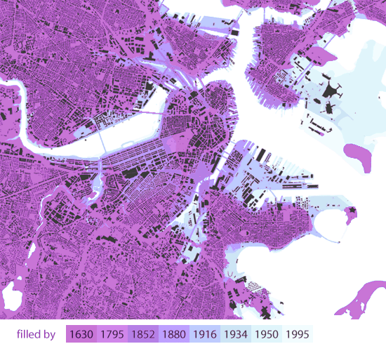
Figure/Ground:
.TIF (2600x2150, 5.8MB)
[best with alternatiff.]
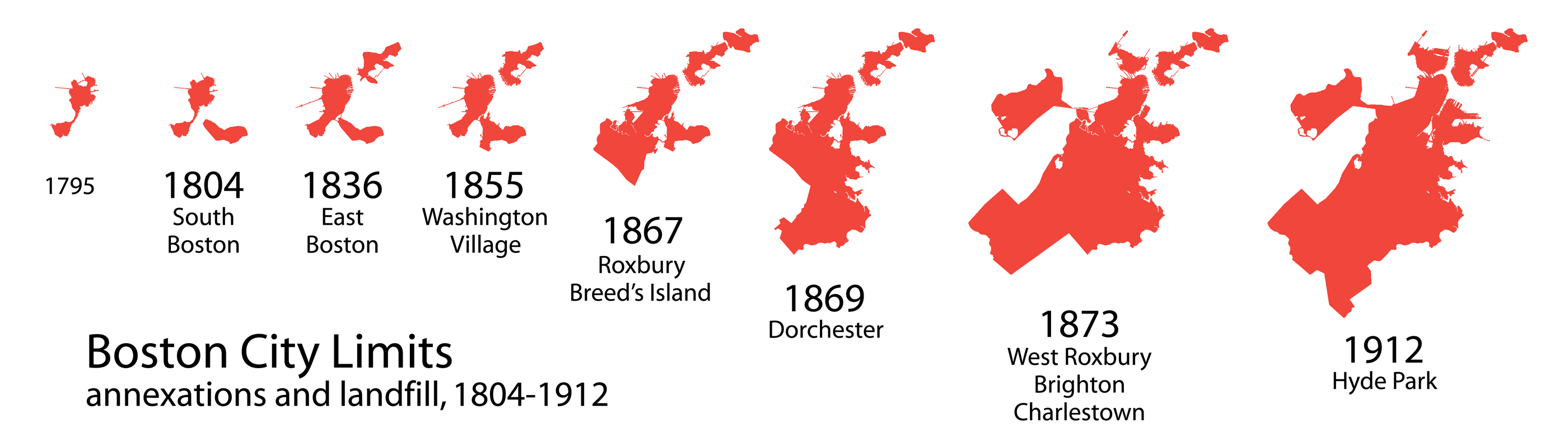
Annexations:
.GIF (2800x800, 130k)
A figure/ground map shows much better than a typical street map the diversity of Boston's development. From the gridded row houses in the Back Bay and South End, meandering suburban streets to the south, gridded three-deckers in Cambridge and South Boston... this variety is in part a record of Boston's piecemeal land reclamation efforts.
Notice how the scale of development has increased in the twentieth century — some of the largest building footprints are located on recently reclaimed land, in Fort Point Channel, Miller's Creek, and the South Bay. The high-res map also shows that Boston has its fair share of modernist housing developments scattered throughout the city.
(Landfill information after Herb Heidt and Eliza McClennan's maps in Mapping Boston.)
