Bill Rankin, 2007, 2009
download:
.PNG (2200x2000, 1.4 MB)
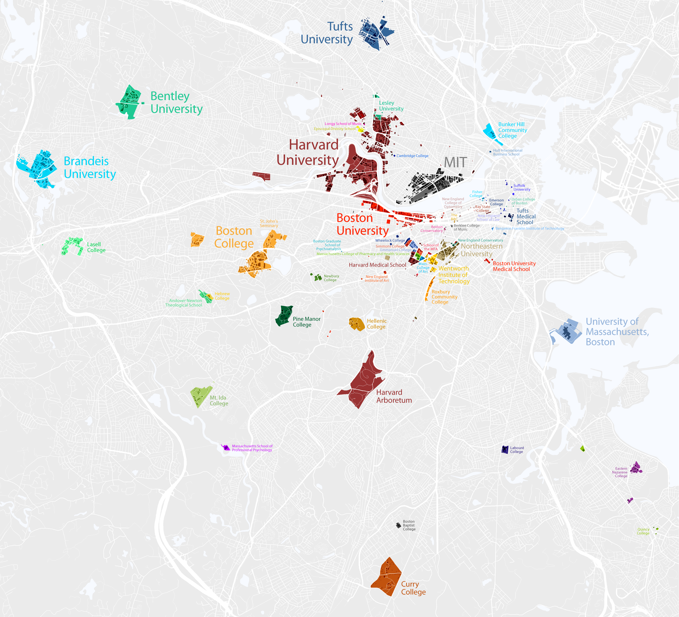
Boston is certainly a “college town,” but most maps show only the smallest version of the university campus — the quad, major buildings, maybe some dorms. (See Google’s map of MIT, for example.) Using municipal property databases, I made a campus map that shows land owned or leased by the fifty-one colleges and universities inside the Boston route-128 loop, including land that is held for non-university uses. Where possible, I also included land that is owned by school-controlled holding companies.
The result is a map that defines Boston as a college town not because there are students roaming the streets of the Fenway, but because huge areas of land aren’t subject to the same property-tax laws as land owned by for-profit organizations.
This is version 2; thanks to Harry Mattison and Alain Poutré for their helpful feedback on version 1.
