Bill Rankin, Louis Hyman, 2003
download:
.PDF (388k)
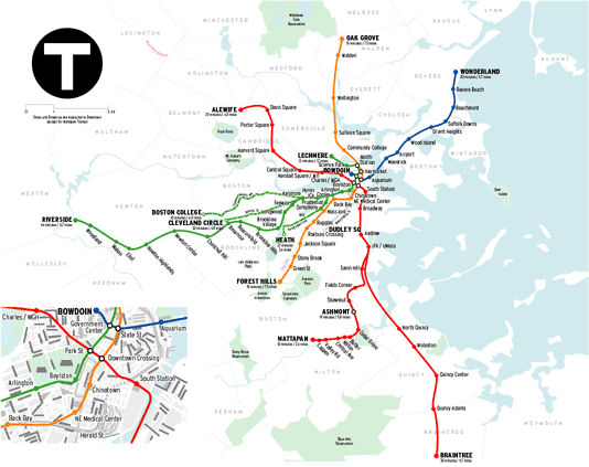
The maps posted in the Boston subway show a strangely self-contained system, with no reference to scale, time, or geography. (click HERE to see it). I'm not convinced that subway maps need to be "abstract," with massive distortion and nothing but forty-five degree angles, especially for small systems like Boston's. Showing parks, the water, and town boundaries is easy to do.
