Bill Rankin, 2006
download:
.TIF (2000x2000, 4.1 MB)
[best with alternatiff.]
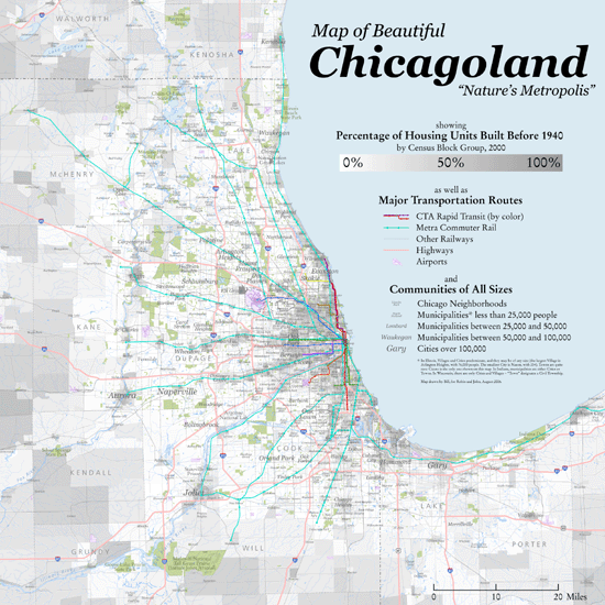
Another attempt to rectify the glaring lack of regional wall maps of US cities. Here a single statistic shows both the commuter-rail driven growth of the early 20th century and the limits of today's car-based development.
And yes, the footnote on the map about the varieties of municipalities is meant as a slap in the face to those people who claim to know what a "real" city is. Municipalities are distinguished by size and by form of government, and in the United States the words village, town, and city denote different kinds of government. Together the villages and cities of Chicagoland form a single metropolis.
