OF THE LOWER
MISSISSIPPI RIVER
Harold Fisk, 1944
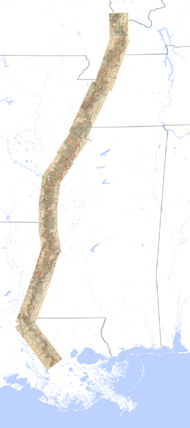
Part of an otherwise technocratic report for the Army Corps of Engineers, Fisk’s maps of the historical traces of the Mississippi River are a wonderful suprise. Presented here are all fifteen maps, stretching from southern Illinois to southern Louisana.
Here is the entire series together (click for a large version):

download:
The composite of all the maps together (10 MB .PNG)
A .ZIP archive of all 15 maps as 96-dpi JPG files — displays the sheets at actual size on most screens (70 MB)
You can also download the entire report, and all the maps at 300-dpi print resolution, direct from the Army Corps of Engineers. (The first links as you scroll down the left column: "Report" is the text of the report with some figures; "Oversized Plates" are high-res PDFs, from which this series is taken — look for plates 22-1 through 22-15; "Oversized Plates Rectified" are GIS-ready TIFs. Warning: their files are very large!)
