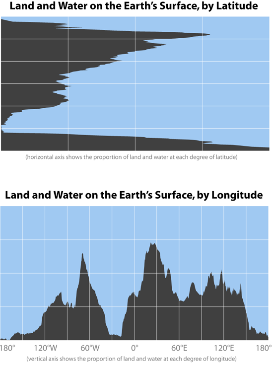
Bill Rankin, 2008
These two graphs show the proportions of land and water on the surface of the earth, summarized by latitude and longitude. For the first, imagine a world map where all the land has been sucked to the left edge of the paper; on the second, all the land has slipped down to the south pole.
Some fun stats: About two-thirds of the world’s land is north of the equator, and about half the world’s land is north of 24°N. Taking both the northern and southern hemispheres together, the world’s land is on average about 37 degrees from the equator.
Note that these diagrams show land as a percentage of surface area at any given latitude or longitude, so only the bottom graph gives an equal-area representation of total land and water. About 71% of the earth is covered by water.
