
Bill Rankin, 2013
download:
Chicago (3000x2600, 2.7 MB)
Houston (3000x2000, 1.9 MB)
Sea Islands (3000x4700, 4.2 MB)
Orlando (3000x2300, 3.0 MB)
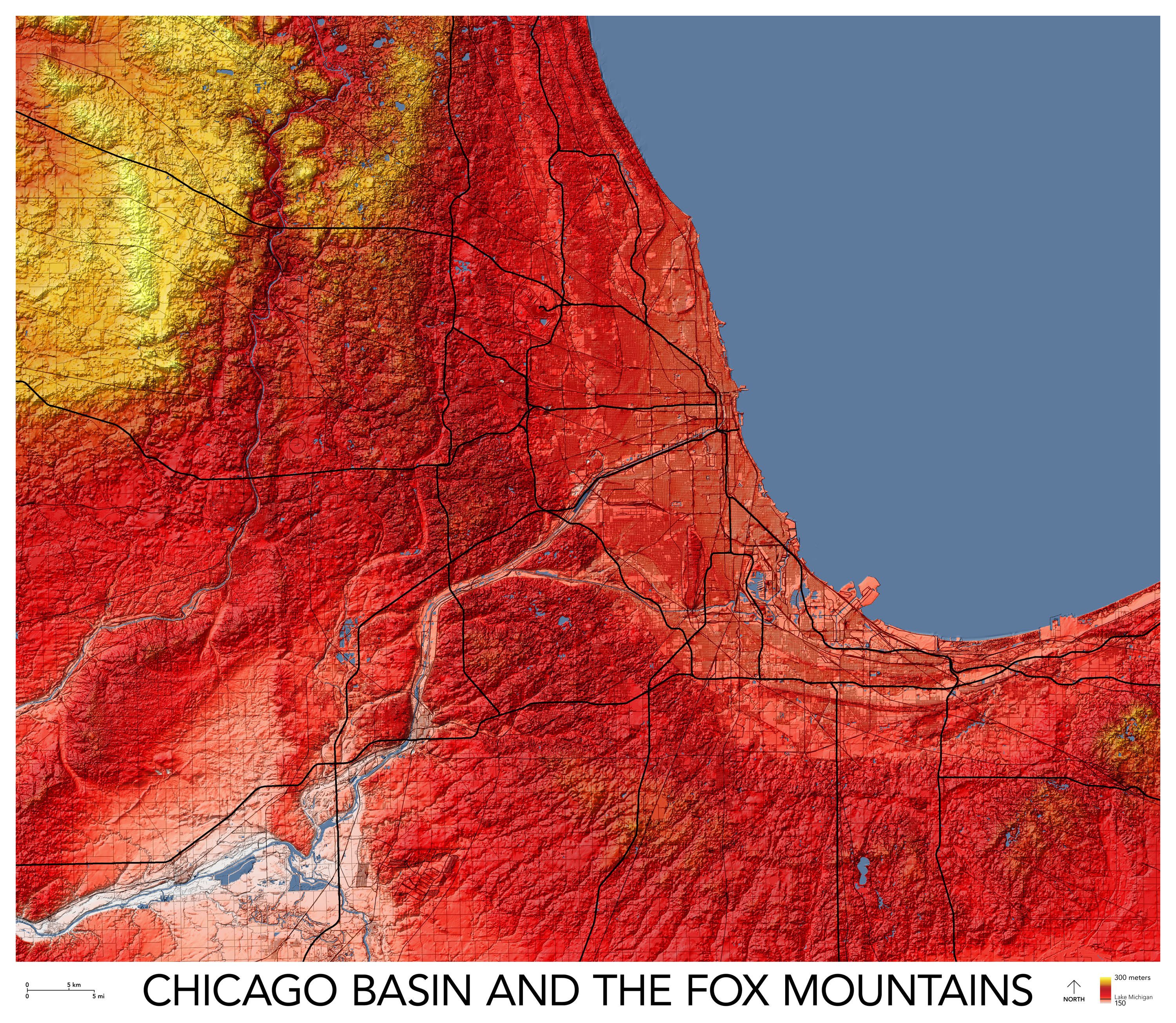
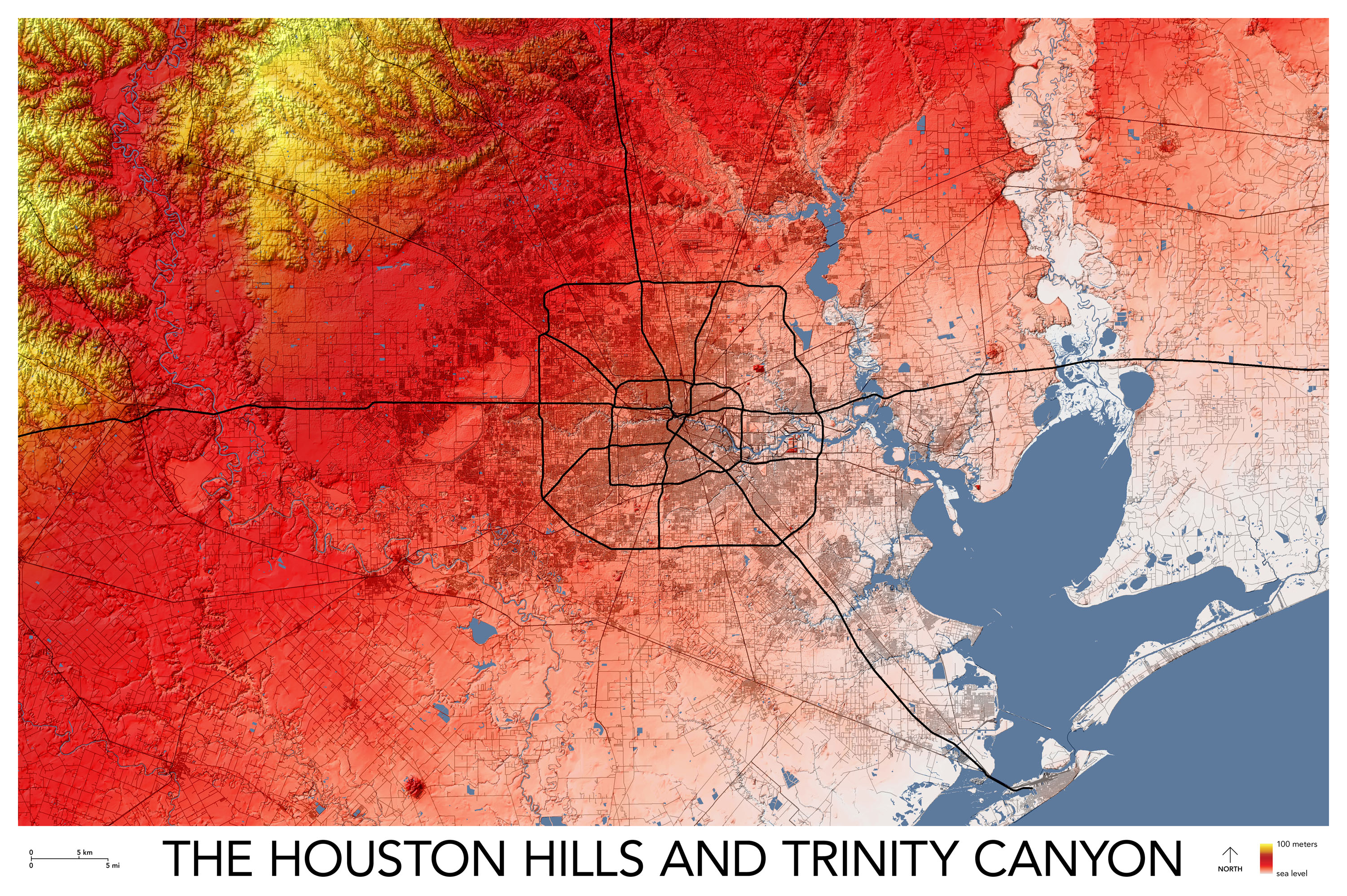
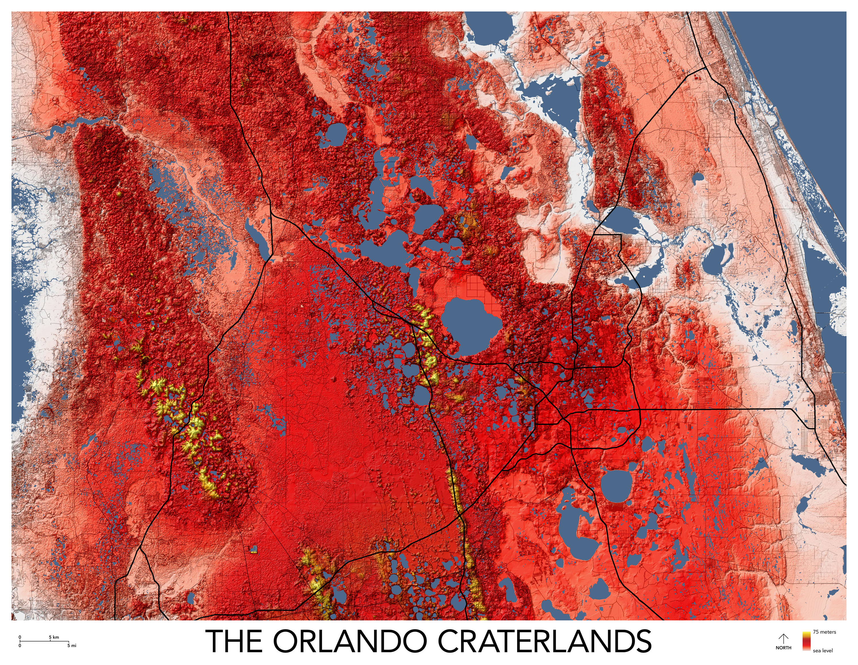
The importance of topography for cities like Los Angeles, San Francisco, Seattle, and Pittsburgh is relatively obvious. The more modest hills of Boston, New York, and Washington DC are also well known, especially to bike commuters. But then there are cities which are simply called "flat," and their expansive flatness is a defining feature of their personality.
What would happen if we took these "flat" areas and drew them with a bit more drama? We would see a magical world of imperceptible topographies: mountains, cliffs, and canyons hiding in plain sight, ignored not just by the street grid but even by the slope-averse railroads. Only water takes notice.
On all four of these maps, the variations in elevation — just a few hundred feet over millions of acres — would barely register on most contour maps (or on the "terrain" view on Google Maps). But the data is there for the taking. Instead of using the same uniform rules to draw all parts of the world, bumpy and flat alike, why not celebrate local nuance?
All maps at the same scale. (Vertical scale adjusted to fit local conditions.)
