Bill Rankin, 2007
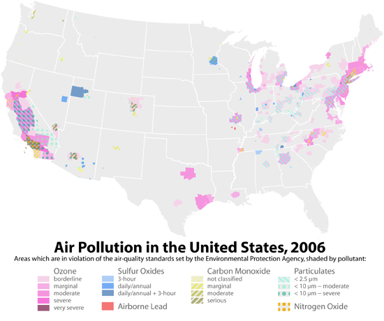
The EPA has maps available for viewing online, but only one pollutant in one state can be viewed at a time (here is the front-page for their viewer). Putting all the data on one map does make it more difficult to see precisely how certain pollutants are being monitored in specific counties, but it also reveals overall patterns which aren’t visible on the EPA maps.
Two patterns seem particularly noteworthy. First is the degree to which California faces more serious air pollution problems than any other state — it has more serious violations of air-quality regulations for more pollutants over larger areas than anywhere else. Second is the fact that air pollution is clearly a regional problem. Northeast Wisconsin and coastal Maine share their air with Chicago and Boston, and the pollution reach of sun-belt cities like Dallas, Houston, and Atlanta extends well beyond their ring roads.
Data source: EPA
